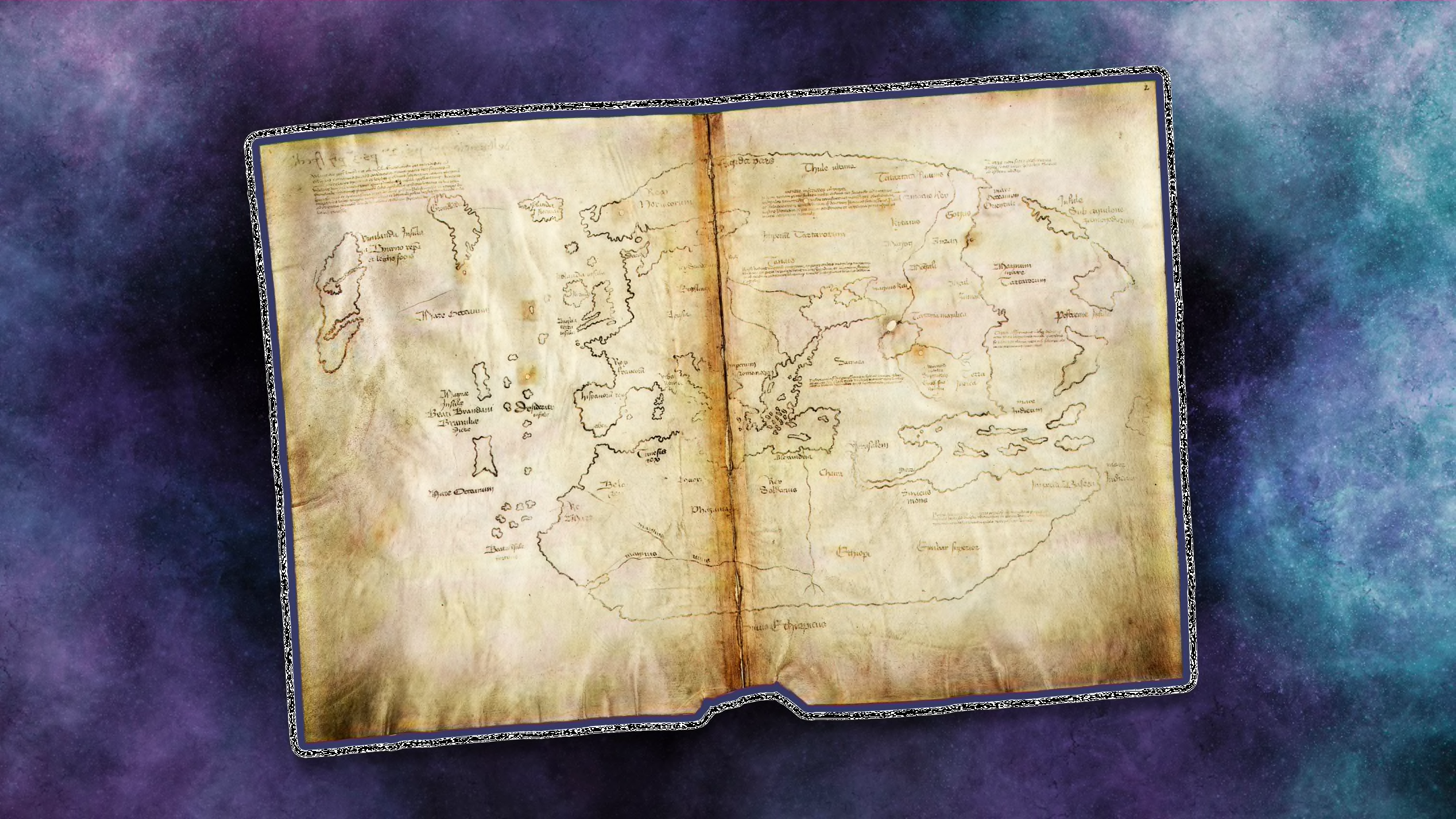
The Vinland Map courted controversy from the moment its discovery was announced. / Beinecke Rare Book and Manuscript Library, Yale University // Public Domain (map); wilatlak villette/Moment/Getty Images (background)
In 1965, Pennsylvania Supreme Court justice Michael A. Musmanno traveled to Yale University to look at a map that, until recently, had been kept a closely guarded secret.
The document, dubbed the Vinland Map, was said to date back to 1440. It was inscribed with a phrase alternately deciphered as Vinlanda Insula, Vimlanda Insula, or Vinilanda Insula, and depicted a version of North America that included Greenland as an island as well as part of what appears to be the North American coast. When translated, text on the map seemed to corroborate the events of what are known as the Vinland Sagas, two 13th-century Icelandic texts that speak of legendary explorer Leif Erikson arriving in North America—likely present-day Newfoundland, Canada—by way of Greenland around 1000. If legit, as the university claimed it was, the map was the earliest representation of North America and provided more evidence that Vikings had made it to the continent nearly 500 years ahead of Christopher Columbus—who, although he sailed for Spain, was Genoese by birth and was later embraced by Italian Americans as a hero.
In a blow to their pride, the map’s existence was announced in a splashy press conference just before the holiday honoring the explorer. With it came a book written by scholars who had worked in secret for seven years to verify the map’s authenticity. “Cartographic Scholarship Turns Over New Leif,” the Los Angeles Times punned.
Read the rest of this article...